
Mount Dana, at 13,061 ft. is the second highest peak in Yosemite and certainly more hike-able than the highest, Mount Lyall, 13,120 ft. The trailhead is right inside the Tioga Pass entrance and climbs 3,000 ft in around 2.5 miles to the summit. Although the trail is steep at times, the hike is relatively straightforward and affords a spectacular panorama of Mono Lake to the east, the broader Yosemite National Park to the south and west, and the mountains that mark the boundary between Yosemite and the Inyo National Forest to the north west.
This peak eluded us in a previous attempt in 2024. Afternoon thunderstorms that commonly spring up in the Sierras were gathering steam and we opted to descend just 1,000 feet short of the summit. This time the weather looked good, some clouds expected early afternoon, but nothing ominous. Of course, the Sierras are never quite that easy!

The first half mile of the hike winds around gorgeous shallow tarns surrounded by pine trees and sub-alpine meadow flowers. Dragonflies skim the water and we’ve seen mule deer grazing among the trees. And, in early summer mosquitos can be plentiful! Great place to stop for a lunch break on the way up, or down.

The trail turns south and then east again and starts to climb more steeply as it rises out of the subalpine forest and into the treeless alpine zone. The views into Yosemite NP expand and a little cloud cover makes them more dramatic. A good chance to see or hear Clark’s Nutcrackers as they fly among the trees now below.

This section of trail climbs about 1,500 feet in one and a quarter miles, the trail becomes rockier as it climbs into the talus, but it’s still visible with smaller switch-backs to make the going easier. At the top of this section there’s a cairn toward the right as you look up. That marks a small plateau, a quarter mile of trail where summit is now more obvious and the trail is easier.

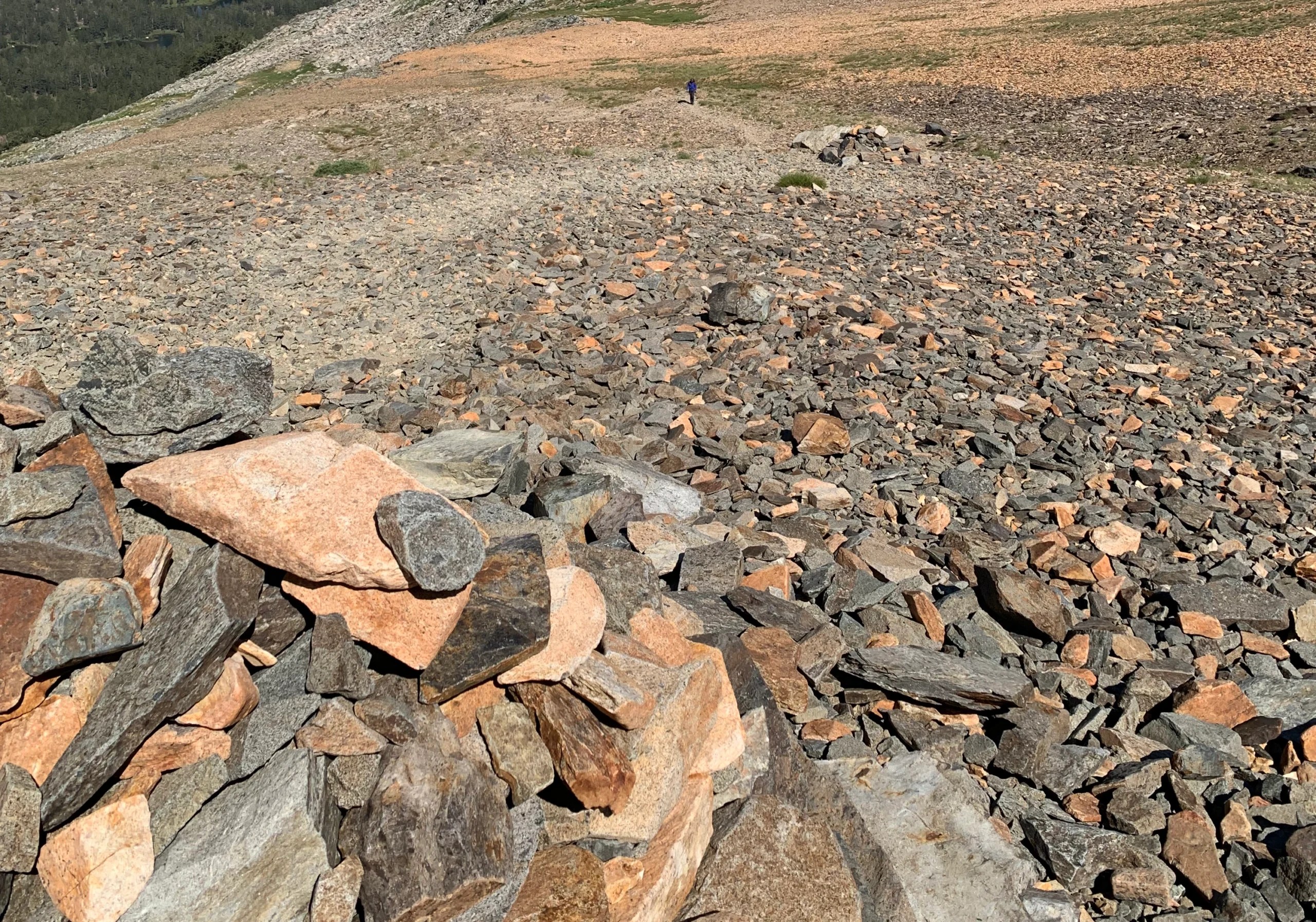


The final upward section is about half a mile and 1,000 feet vertical of talus. The trail is harder to track, although cairns mark the way. At this point the weather changed. The projected light clouds turned into more ominous skies. A couple of lightning strikes two to three miles to the south east and a short, but heavy hailstorm forced us into rain gear.

Fortunately, a strong breeze pushed the cloud cover to the south of the summit and after a quick snack break at a lower cairn we were able to push on. Arrived at the summit after 3-ish hours and even with less than stellar weather, the scenery was magnificent.

In ‘A Climber’s Guide to the High Sierra’ edited by Hervey Voge, the writers of the Cathedral Range section note of Mt. Dana – ‘First ascent June 28th, 1863, by W.H. Brewer and C.F. Hoffman, who found the view so impressive that J.D. Whitney climbed the peak the next day’. That’s J.D. Whitney who is memorialized by Mount Whitney. And, as we were hiking up, everyone coming down noted that the trip would be well worth the effort. Indeed it is!


Getting there:
For the east side of Yosemite we’ll often stay in Lee Vining. It’s a nice little town close to the junction of Hwy 395 and Rte 120, the Tioga Pass. There’s usually a good selection of accommodation, food, gas. And, it’s 13 miles from the trailhead, 20 minutes in good traffic.

© Mapbox, © OpenStreetMap, Improve this map
The trailhead is east of the entrance gate and although there is a small parking lot on that side of road, it’s usually blocked for government vehicles. Two other lots are easily accessible. The one to the west has bathrooms and bear lockers. However, it’s often full. The lot to the east, about 1/10th mile further, is generally wide open. Drop your food etc. into the west-side bear lockers as you walk by.

Map generated from CalTopo.com, reproduced with permission. © Caltopo, OpenStreetMap contributors, and including various 3DEP digital elevation models all in the public domain
Other Considerations:
– Altitude
This hike pushes up to 13,000 ft. in a short time. And, especially for those coming up to Tioga Pass directly from sea-level the lower oxygen content can be noticeable. We were certainly moving more slowly on the final 1,000 ft.
Indeed, altitude sickness can range from mildly debilitating (shortness of breath, headache, nausea, fatigue) to potentially deadly (high altitude cerebral edema – HACE, and high altitude pulmonary edema – HAPE).
There are several measures visitors to the High Sierras should make themselves aware of through the many excellent articles on the subject, including but not limited to “High-Altitude Illnesses: Physiology, Risk Factors, Prevention, and Treatment, Andrew T. Taylor“.
– Entrance Fees
Yosemite NP has a range of fees and passes for vehicles, and passengers. There are a number of pull outs before the entrance gate and we haven’t tested whether you’ll be allowed on the trail without actually entering the park. This might be worth checking if Mount Dana is your only Yosemite stop.
In past years Yosemite NP has used reservation programs to limit the number of visitors. Reservations were not required in 2026.
– Other Opportunities Nearby
The Gaylor Lake trail to the west of the Rte 120 is beautiful and not difficult. There’s a climb over a ridge with great countryside on the other side. Beyond these two trails there are other wonderful hikes and stopping points along Rte 120, including Tuolumne Meadows, and Olmsted Point overlooking the granite canyon into the valley itself.